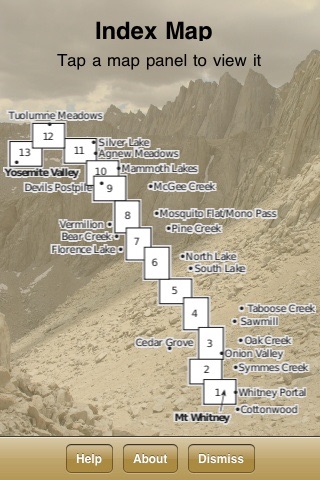


John Muir Trail Map app for iPhone and iPad
Developer: Earthrover Software
First release : 07 Jul 2010
App size: 32.51 Mb
This is an essential app if youre hiking the John Muir Trail. It contains the complete John Muir Trail Map Set from Tom Harrison Maps. No internet connection is required--all data is included in the app itself, and scrolling and zooming with standard iPhone gestures is fast and smooth.
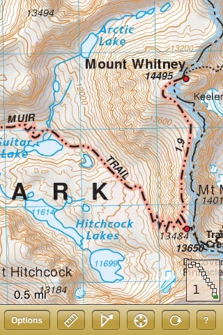
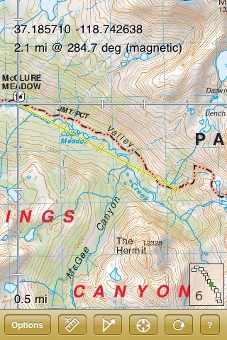
The map shows trails, roads, vegetation, water features, peaks, campgrounds, and more, all with 80-foot contours overlying a shaded relief topo map.
The map works with the iPhones GPS, so you can easily find your place on the map anywhere on the trail. You can add markers and bearings, use UTM or latitude longitude coordinates, and display coordinates in WGS84 or NAD1927 datums. The app includes built-in help and an overview map to let you quickly navigate to any spot on the trail.
iPad users: This app works on an iPad, but has not been optimized to take advantage of the iPads higher-resolution screen.